Today Weather Update: Saturday proved to be a restless day for Wales. The Met Office issued a yellow warning for the entire day due to heavy rain, increasing the risk of flooding in coastal Wales and northern parts. Continuous rain throughout the day raised river levels and affected several districts.
Flood alerts in six major catchments
Natural Resources Wales (NRW) reported that the Gower Peninsula, the western Cleddau, River Taff and Cynin, northern Gwynedd, Conwy, and Glaslyn and Dwyryd catchments could be severely affected. Experts warned that flooding of low-lying land and roads in these areas is possible, and some residential and commercial properties may also be submerged.
Continuous rain worsens conditions
Saturday’s forecast for Wales was extremely worrying. The Met Office said, “Heavy and persistent rain will occur throughout the day, which could lead to flooding and travel disruption.” This warning reflects concerns not only for public safety but also the pressure on essential services. The situation is worsening due to rising river levels in Pembrokeshire and Carmarthenshire.
The danger will continue until Sunday.
The Met Office’s yellow warning came into effect on Saturday morning and will remain in effect until 3 p.m. on Sunday. The list of affected districts is long, including Bridgend, Carmarthenshire, Ceredigion, Conwy, Denbighshire, Flintshire, Gwynedd, Isle of Anglesey, Merthyr Tydfil, Neath Port Talbot, Pembrokeshire, Powys, Rhondda Cynon Taf, Swansea, and Wrexham. This warning clearly indicates that a large part of Wales is under severe weather pressure these days.
How much rain and where?
Forecasts indicate that 20 to 30 mm of rain is expected between Saturday morning and Sunday, with some areas seeing 60 to 80 mm of rain. Significantly, this heavy rainfall will not be limited to mountainous areas but will also impact urban and vulnerable areas. If this possibility becomes stronger, the Meteorological Department may upgrade this warning to a more severe category.
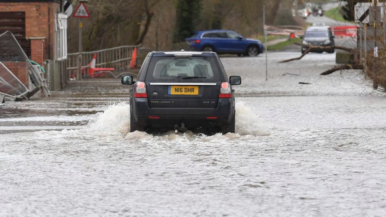
Floods and Travel Disruptions
The impact of heavy rain and the threat of flooding is not limited to homes. Road traffic and rail services are also likely to be disrupted. Waterlogging on many routes may make travel difficult. Officials are constantly monitoring the situation, and residents are being advised to remain vigilant.
Relief Expected: Weather Changes From Monday
While Saturday and Sunday were fraught with rain and the risk of flooding, conditions are expected to change from Monday. Weather experts say that after the rain subsides, a high-pressure area will form over Britain, leading to clear skies. Sunday will be somewhat unsettled, with sunny spells and scattered showers possible, but dry and stable weather will return from Monday.
Forecast for Next Week
The Met Office predicts sunny skies on Monday, with cloudy skies on Tuesday and Wednesday. However, frost and a chilly night are expected in rural areas. This change will bring relief to residents currently worried about flooding.
Public Vigilance Appeal
Natural Resources Wales has urged residents and businesses to take weather alerts seriously. Rain and rising river levels could make the situation dangerous. Officials are monitoring the situation closely, but local residents must also take their own precautions to stay safe.