UK weather: Britain is set to face a massive and dangerous storm this weekend. The latest weather maps indicate that an 880-mile-long storm, originating in the Atlantic Ocean, is poised to wreak havoc across the country on Saturday, September 27th. Its effects will be felt from Land’s End in southwestern England to Fraserburgh in northeastern Scotland. Experts say this storm will bring about major changes in Britain’s weather.
Which Areas Are Most at Risk?
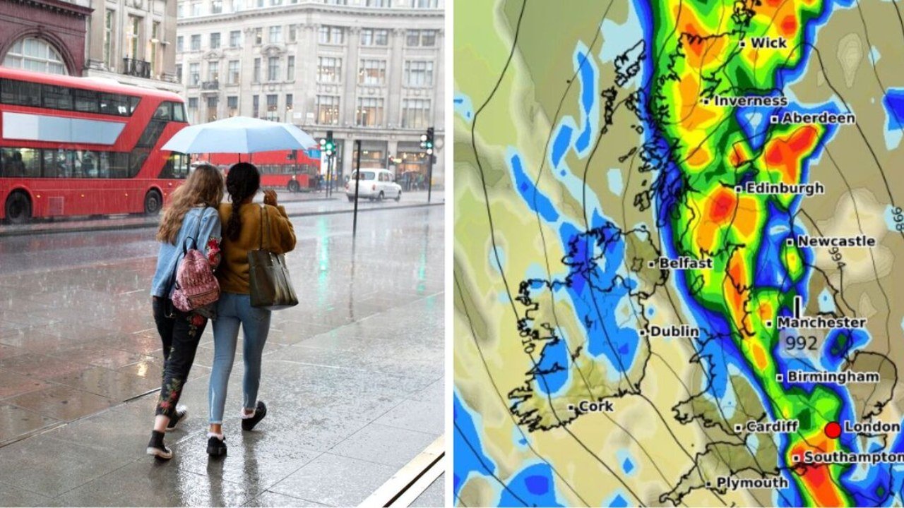
According to maps, the storm will spread across southern and northern England, the Midlands, northern parts of Wales, and central and southern Scotland. Northern Ireland may also be affected. It will not be limited to the western coast; eastern areas of the country are also expected to be affected. Weather experts have warned that the storm will likely continue to move eastward over the weekend.
What will the weather be like now?
According to the Meteorological Department, generally stable weather conditions will prevail from September 24th to October 4th. Most days will be dry, with light winds and sunshine. However, a patch of fog may appear at night. Dense clouds and rain have already begun to form in the northwest, signaling an impending storm.
Express and BBC reports
Express reports that the eastern regions are likely to be most affected by the storm by next weekend. Weather experts believe this change may also be linked to the impact of Hurricane Gabrielle in the east, which is currently approaching Britain. The coming week will see a clear division between the western and eastern regions. Rain and strong winds will occur in the west, while the east may experience relatively dry weather.
According to the BBC, the weather will be normal on Tuesday and Wednesday, with a mix of sunshine and clouds. However, light rain is possible in the far southeast. Starting Thursday, winds will increase in the northwest, bringing with them clouds and possible showers. Temperatures are also expected to rise above average during this time.
Floods Hit Before the Storm
This warning comes as Britain has recently been hit by flooding. Heavy rains disrupted life in many parts of the country. Flooding near Huddersfield forced authorities to close a lane on the M62 highway. Entire roads in the Salford area of Greater Manchester were submerged. These incidents have increased public concern, as the impending storm threatens to worsen the situation.
Experts Warn
The Met Office and experts have clearly stated that the storm’s size and speed could pose a significant challenge to Britain. Some maps indicate that winds could reach 99 mph during the storm. Weather maps have already turned dark purple, indicating a severe threat.
Advice for the public
Experts have urged people to monitor weather updates over the next few days. Residents in coastal and northern areas, in particular, need to be cautious. Relief and safety arrangements in flood-affected areas are advised to be made in advance.